
Regular readers of this blog will note a recurring theme, railways. Today’s walk was chosen for two key reasons. 1. There are no fords to fall in. 2. We get to walk along an old track bed. By the way, many thanks to Warwickshire Railways for the photo of Broom Junction in its pomp.
Today I was walking on behalf of Myton Marathon with my silver haired walking friend. This is the second walk towards my 26.2 mile target. The first, a soggy 5.55 mile contribution. SHWF and I have walked this route several times so today I m confident. What could possibly go wrong?
It is a stunningly beautiful, if chilly day. The sky is a clear, crystal blue. Perfect for our walk. The chat begins as we stroll up the lane towards the footbridge and then the track towards Oversley Castle and one of my favourite viewpoints around Alcester. The vista sweeps from the Malverns in the west to the Cotswold escarpment in the south and ranges over the Vale of Evesham.

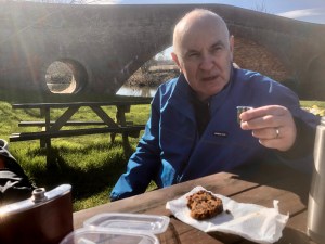
From here the path winds down to the timbered village of Wixford and our first refreshment stop. Sadly, The Fish Inn is closed at the moment so weborrowed a table for our repast of Mrs SHWF’s Christmas cake and some fortified coffee. Delicious!
Much cheered, we continued along the Heart of England Way towards Broom. First through a small wood past a delightful waterfall and thence crossing several fields abounding with tiny leaping lambs and their watchful mothers. This section of the walk is not long, just far enough to raise a thirst.
Suitably refreshed again, SHWF and I proceed over the River Arrow and turn take the path back towards Wixford. Beyond the remains of the station the route drops onto the old track bed for short stretch (circa 1.5m) alongside the River. At Wixford the path drops down a steepish embankment at Wixford station where crumbling remains of the platform are still visible.
The Redditch Railway built the line between Barnt Green and Aschurch during the 1860s. It provided worthwhile service to the villages along its route and a valuable bypass to the infamous Lickey Incline. The line, known as the Gloucester Loop was adopted by LMS in 1923 and finally closed by BR in June 1963 leaving only the section between Barnt Green and Redditch.
But back to the walk. We have now passed under the A46 and are approaching Arrow where we are forced off the line, through a gate. Thence through a convoluted array of gates, bridges and embankments we emerge in Alcester and the end of our walk. The sun still shining, it was time to investigate the contents of my fridge for a beer.
Broom Junction has contributed 6.61 miles towards my 26.2 mile target which, added to my 5.55 miles already walked gives me a total of 12.16 miles.
Our walk can be followed in OS Explorer 205. I have placed instructions starting from St Nicholas’ Church in Alcester in the Walks tab
